Local News
RIT receives NASA funding to expand community-driven remote sensing research and field experiments

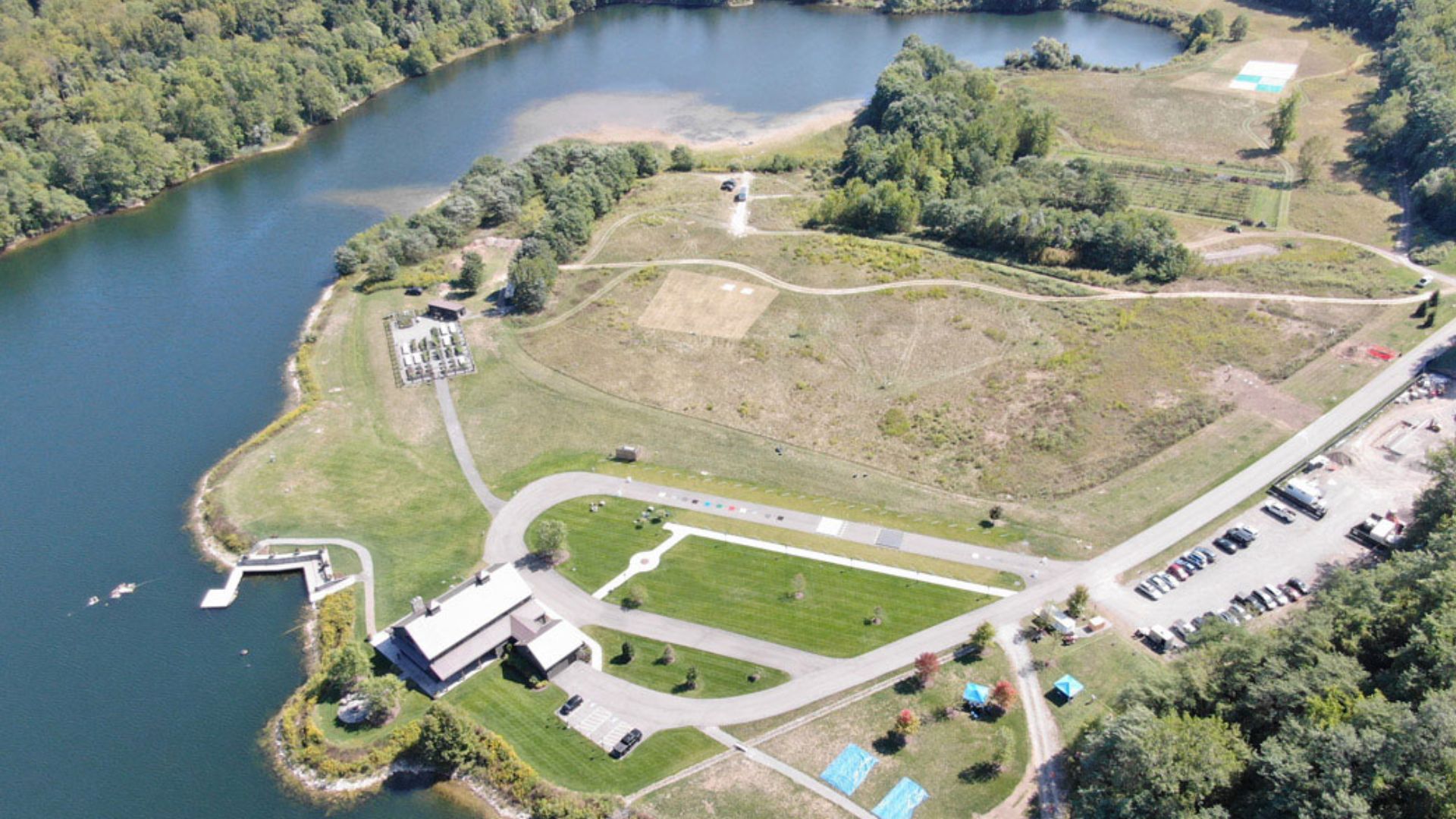
Rochester, New York – Rochester Institute of Technology has received NASA support for a new remote sensing effort that will bring researchers together for field experiments while making the collected information available to a much wider scientific community.
NASA awarded RIT’s Digital Imaging and Remote Sensing Laboratory, known as DIRS, a three-year grant to lead a remote sensing field campaign. Data produced through the project will be shared with researchers, educators, and members of the public.
The funding comes through NASA’s Commercial Satellite Data Acquisition Program and builds on work already completed through ROCX 2025, a community-driven field campaign held at RIT’s Tait Preserve.
That campaign brought together 75 participants representing 24 organizations from six countries. Researchers carried out 19 ground experiments and used a wide range of equipment to collect information from different perspectives.
The effort included 14 ground instruments and eight unmanned aerial vehicle platforms. Researchers also used two aircraft and data from seven satellite platforms.
Remote sensing technology allows researchers to gather information about the Earth without having to directly contact the objects or areas being studied. As imaging systems and sensors continue to improve, however, scientists still need reliable field measurements that can be compared with information collected from aircraft and satellites.
High-quality datasets supported by measurements taken on the ground are particularly important for calibrating and validating sensors. They can also help scientists develop and test new algorithms and improve future Earth observation technologies.
The new NASA-supported project will expand on the approach used during ROCX 2025.
RIT researcher Nina Raqueno and Gerald W. Harris Endowed Professor Emmett Ientilucci are leading the effort. The project is expected to increase community participation, expand data collection, and provide broader open access to the information produced during the campaigns.
Planning for the next stage is already moving forward.
Researchers will meet for the ROCX Workshop on Oct. 23. Participants will present findings from ROCX 2025 while also beginning preparations for the next major field campaign, ROCX 2027.
The DIRS Lab is part of RIT’s Chester F. Carlson Center for Imaging Science. Its work focuses on developing tools and methods for extracting useful information about the Earth from satellite and aerial imaging systems.
The laboratory applies science and engineering across different stages of remote sensing problems, from collecting information to analyzing and using the resulting data. DIRS also maintains research partnerships with several federal agencies, businesses of different sizes, and other academic institutions.
RIT’s imaging science program has a notable place in the field. The Chester F. Carlson Center for Imaging Science established the first imaging science program in the United States and currently operates the nation’s only formal program dedicated specifically to imaging science.
The interdisciplinary field brings together areas including computer science, engineering, and physics. Researchers use those disciplines to study how images are created, how people and systems perceive them, and how information can be extracted through image analysis.
Read also: Port Chester man charged with Leandra’s Law DWI after police find 14-year-old passenger in vehicle
Several parts of RIT also contributed to making the NASA-supported work possible.
Staff at the Tait Preserve have supported the field campaign activities, while RIT Research Computing provides the GLOBUS infrastructure used for managing ROCX information. That system allows the datasets to be maintained over the long term and distributed publicly.
With the new three-year NASA award, RIT will now have an opportunity to build on the international participation seen during ROCX 2025, collect additional remote sensing data, and make those resources available for future research, education, and Earth observation development.


-
 Local News1 year ago
Monroe County announces legal proceedings against properties listed in official public notice of foreclosure
-

 Local News2 years ago
New ALDI store close to Rochester to begin construction in late 2025 or early 2026
-

 Local News1 year ago
County Executive Adam Bello and members of the county legislature celebrate exceptional young leaders and advocates at the 2025 Monroe County Youth Awards
-

 Local News1 year ago
The 2025 Public Market Food Truck Rodeo series will begin this Wednesday with live music by the Royal Bromleys