Local News
NASA awards Rochester Institute of Technology $2.2 million to advance Landsat 10 satellite research ahead of its planned 2031 deployment

Rochester, New York – Rochester Institute of Technology will continue its long-running work with NASA and the federal Landsat program after receiving a $2.2 million grant to support the development of the next generation of Earth-observing satellites.
The funding will allow RIT researchers to carry on their work preparing Landsat 10, previously known as Landsat Next, for its planned deployment in 2031. The project is focused on understanding how the satellite’s imaging instruments will perform and helping scientists make decisions that could affect the quality of the information collected from space.
The new award extends a partnership that has connected RIT with the Landsat program for decades. The collaboration began in 1981, when NASA provided the university with its first major research grant, helping establish the imaging science program that later became a central part of the institute’s work.
Landsat is a joint NASA and U.S. Geological Survey program that began in 1972. It has created the longest continuous space-based record of Earth’s land surfaces, providing information that scientists, governments, and other users rely on to understand changes in the environment and manage natural resources.
The satellite program has been used to study everything from forests and farmland to water supplies and changing landscapes. Its data can help researchers track environmental conditions over time and support decisions involving agriculture, conservation, climate research, and land management.
Read also: Henrietta residents face September 15 deadline for first installment of 2026 school tax bill
At RIT, research faculty members Rehman Eon and Aaron Gerace from the Chester F. Carlson Center for Imaging Science are leading the new project. Their work will focus on the Landsat Instrument Suite, known as LandIS, which is being developed for the upcoming mission.
“We’re excited to continue this work with NASA,” said Gerace. “We essentially conduct simulated sensor trade-studies for the imaging sensor to illustrate the impact of sensor design on image quality.”
In practical terms, the team will use computer simulations and modeling to examine how different sensor designs could affect the images produced by Landsat 10. These studies can help show how changes in the instrument might influence the satellite’s ability to collect useful scientific information.
The LandIS sensors will be different from those used on earlier Landsat missions. The new instruments are expected to collect images across 26 spectral bands and provide higher spatial resolution. Spectral bands allow scientists to examine how materials on Earth reflect or emit different types of light, while spatial resolution affects the level of detail visible in an image.
Because of these changes, the RIT researchers will conduct targeted studies to assess the performance of the new sensors. Their analyses will give the Landsat program additional information as it evaluates instrument designs and works toward meeting the scientific goals of the mission.
“The design of this new instrument is important,” said Eon. “Not only will it provide continuity with previous Landsat sensors, but it will enable emerging science applications due to its improved spectral and spatial resolutions.”
Maintaining continuity with earlier Landsat satellites is an important part of the project. Researchers depend on long-term observations to compare conditions across decades, making it possible to identify gradual changes in land, water, vegetation, and other parts of the environment.
At the same time, the improved capabilities of Landsat 10 could support new types of research. More detailed images and additional spectral information may help scientists investigate questions that were harder to address with older instruments.
The mission is expected to continue Landsat’s role in monitoring and understanding Earth’s changing surface. Among the areas supported by Landsat data are water quality, aquatic health, crop production, soil conservation, forest management, climate and snow dynamics, and mineral mapping based on thermal emissivity.
RIT’s researchers will use a modeling system called DIRSIG, short for Digital Imaging and Remote Sensing Image Generation, to carry out much of their work. The model was developed at RIT in the late 1980s and has been used to create simulated images and study how remote-sensing instruments capture information.
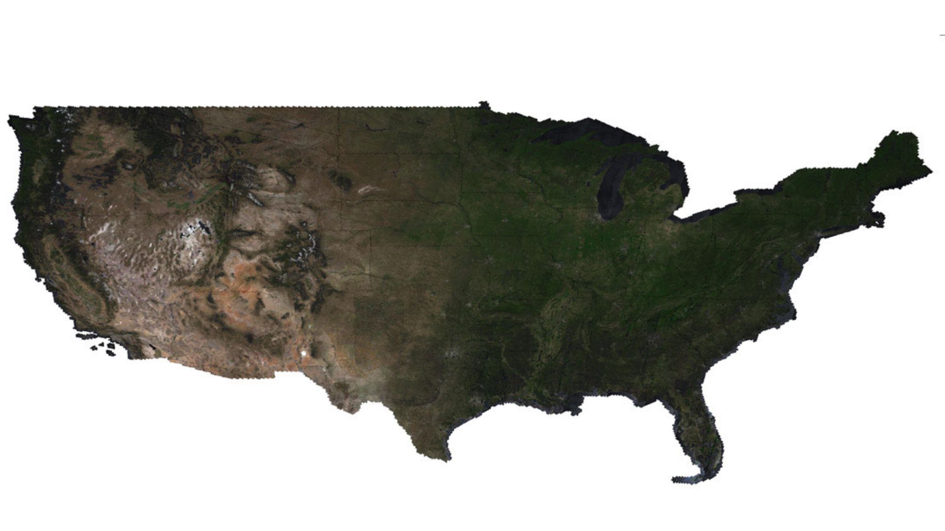
As part of the new project, Eon and Gerace will rely on a large synthetic landscape developed during an earlier contract with NASA and the USGS. The simulated scene will be used to generate proxy data that scientists can apply to their own research methods and computer algorithms.
Rather than waiting for the new satellite to be launched, researchers can use these simulated datasets to study possible instrument performance and explore how different scientific applications may respond to the data. This allows the team to examine potential issues and opportunities during the development process.
The project also reflects RIT’s broader history in imaging science, an interdisciplinary field that combines computer science, engineering, and physics to study how images are created, perceived, and analyzed.
The Chester F. Carlson Center for Imaging Science established the first imaging science program in the United States and remains the only formal imaging science program of its kind in the nation, according to RIT. Both Eon and Gerace graduated from the center’s imaging science Ph.D. program, where they worked on Landsat-related research as students.
The new NASA grant will also involve other researchers who share that academic background.
“This new grant from NASA shows the value of our imaging science background,” added Gerace. “All five researchers that support this project graduated from the program and we are able to use techniques that we learned to build large synthetic landscapes, for example, to conduct studies that are impactful for NASA and USGS.”
With the new funding, RIT researchers will continue contributing to the preparation of Landsat 10 while building on a relationship that has lasted more than 40 years. Their work will support efforts to ensure that the next satellite can produce reliable, detailed information for scientists studying the planet long after its planned launch in 2031.


-

 Local News1 year ago
Monroe County announces legal proceedings against properties listed in official public notice of foreclosure
-

 Local News2 years ago
New ALDI store close to Rochester to begin construction in late 2025 or early 2026
-

 Local News1 year ago
County Executive Adam Bello and members of the county legislature celebrate exceptional young leaders and advocates at the 2025 Monroe County Youth Awards
-

 Local News1 year ago
The 2025 Public Market Food Truck Rodeo series will begin this Wednesday with live music by the Royal Bromleys